
Katrineholms kommun topographic map
Interactive map
Click on the map to display elevation.
About this map
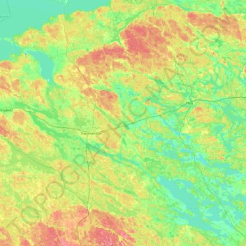
Name: Katrineholms kommun topographic map, elevation, terrain.
Location: Katrineholms kommun, Comté de Södermanland, Suède (58.76916 15.76242 59.26301 16.62588)
Average elevation: 52 m
Minimum elevation: 16 m
Maximum elevation: 122 m
Other topographic maps
Click on a map to view its topography, its elevation and its terrain.