
Kyenda topographic map
Interactive map
Click on the map to display elevation.
About this map
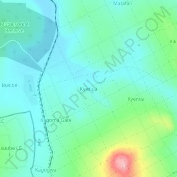
Name: Kyenda topographic map, elevation, terrain.
Location: Kyenda, Jinja, Eastern Region, Uganda (0.53849 33.22606 0.57849 33.26606)
Average elevation: 1,129 m
Minimum elevation: 1,092 m
Maximum elevation: 1,255 m