
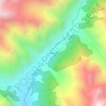
Lidderwat topographic map
Interactive map
Click on the map to display elevation.
About this map
Name: Lidderwat topographic map, elevation, terrain.
Average elevation: 3,436 m
Minimum elevation: 2,717 m
Maximum elevation: 4,458 m
Other topographic maps
Click on a map to view its topography, its elevation and its terrain.
Sundersar
India > Jammu and Kashmir > Pahalgam
Sundersar, Pahalgam, Anantnag District, Jammu and Kashmir, India
Average elevation: 3,989 m
Pahalgam
India > Jammu and Kashmir > Pahalgam
Pahalgam, Anantnag district, Jammu and Kashmir, 192126, India
Average elevation: 2,700 m
Amarnath Cave Temple
India > Jammu and Kashmir > Pahalgam
Amarnath Cave Temple, Amarnath, Pahalgam, Anantnag district, Jammu and Kashmir, India
Average elevation: 4,325 m