
North Pine River topographic map
Interactive map
Click on the map to display elevation.
About this map
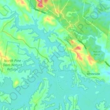
Name: North Pine River topographic map, elevation, terrain.
Location: North Pine River, Caboolture, Queensland, 4510, Australia (-27.27011 152.85772 -27.21740 152.93669)
Average elevation: 55 m
Minimum elevation: 23 m
Maximum elevation: 175 m
Queensland trails, hiking, mountain biking, running and outdoor activities
Other topographic maps
Click on a map to view its topography, its elevation and its terrain.