Geolocate

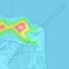
Mount Louisa topographic map

Click on the map to display elevation.

About this map

Name: Mount Louisa topographic map, elevation, terrain.

Location: Mount Louisa, Townsville, Townsville City, Queensland, 4817, Australia (-19.27892 146.74262 -19.27882 146.74272)

Average elevation: 28 m

Minimum elevation: 4 m

Maximum elevation: 191 m

Queensland trails, hiking, mountain biking, running and outdoor activities

Other topographic maps

Click on a map to view its topography, its elevation and its terrain.
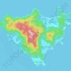
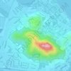
Victoria Park

Australia > Queensland > Townsville

Average elevation: 7 m

The Strand

Australia > Queensland > Townsville

Average elevation: 21 m

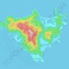
Magnetic Island

Australia > Queensland > Townsville

Average elevation: 54 m

Castle Hill

Australia > Queensland > Townsville

Average elevation: 39 m

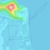
Pallarenda

Australia > Queensland > Townsville

Average elevation: 14 m

Castle Hill

Australia > Queensland > Townsville

Average elevation: 39 m

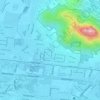
West End

Australia > Queensland > Townsville

Average elevation: 32 m

Magnetic Island

Australia > Queensland > Townsville

Average elevation: 54 m

Gear up for your next adventure:

👣Snake & Scrub Gaiters - Protection against spinifex, mud, and snakes while walking off-track
☕Outdoor Coffee Makers - Enjoy quality coffee at the summit of your favorite peak
📖Australian Bush Survival Books - Local knowledge on finding water and surviving the outback
🛌Compact Down Sleeping Bags - Warmth without the bulk, ideal for backcountry camping
🧢Wide Brim Sun Hats - Maximum coverage for the face and neck while out in the open

As an Amazon Associate, this site earns from qualifying purchases at no extra cost to you.