
Orangeburg County topographic map
Interactive map
Click on the map to display elevation.
About this map
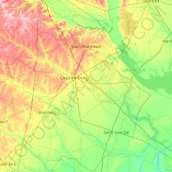
Name: Orangeburg County topographic map, elevation, terrain.
Location: Orangeburg County, South Carolina, USA (33.17724 -81.37269 33.70691 -80.22250)
Average elevation: 53 m
Minimum elevation: -1 m
Maximum elevation: 175 m
Other topographic maps
Click on a map to view its topography, its elevation and its terrain.