
Reid River topographic map
Interactive map
Click on the map to display elevation.
About this map
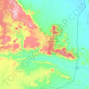
Name: Reid River topographic map, elevation, terrain.
Location: Reid River, Townsville, Queensland, Australia (-19.78329 146.57523 -19.56567 146.91797)
Average elevation: 235 m
Minimum elevation: 39 m
Maximum elevation: 738 m
Queensland trails, hiking, mountain biking, running and outdoor activities
Other topographic maps
Click on a map to view its topography, its elevation and its terrain.