
Argyle topographic map
Interactive map
Click on the map to display elevation.
About this map
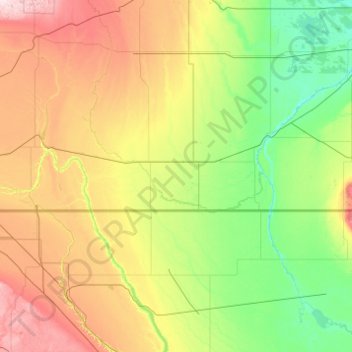
Name: Argyle topographic map, elevation, terrain.
Location: Argyle, Saskatchewan, Canada (48.48167 -102.12665 49.76167 -100.84665)
Average elevation: 522 m
Minimum elevation: 423 m
Maximum elevation: 821 m
Other topographic maps
Click on a map to view its topography, its elevation and its terrain.
Saskatoon
Saskatoon lies on a long belt of rich, potassic chernozem in middle-southern Saskatchewan and is found in the aspen parkland biome. The lack of surrounding mountainous topography gives the city a relatively flat grid, though the city does sprawl over a few hills and into a few valleys. The lowest point in the…
Average elevation: 504 m
Northern Saskatchewan Administration District
Canada > Saskatchewan > Northern Saskatchewan Administration District
Average elevation: 424 m