
Banjarnegara topographic map
Interactive map
Click on the map to display elevation.
About this map
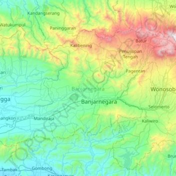
Name: Banjarnegara topographic map, elevation, terrain.
Location: Banjarnegara, Central Java, Java, Indonesia (-7.54075 109.36142 -7.17116 109.91772)
Average elevation: 574 m
Minimum elevation: 3 m
Maximum elevation: 2,582 m
Other topographic maps
Click on a map to view its topography, its elevation and its terrain.