Geolocate

Nanango topographic map

Click on the map to display elevation.

About this map

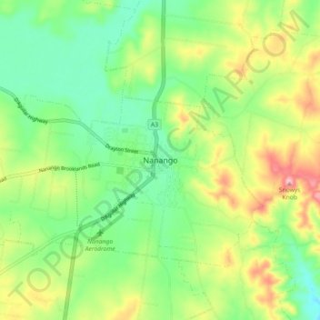
Name: Nanango topographic map, elevation, terrain.

Location: Nanango, South Burnett Regional, Queensland, Australia (-26.71261 151.96297 -26.63261 152.04297)

Average elevation: 382 m

Minimum elevation: 311 m

Maximum elevation: 500 m

Queensland trails, hiking, mountain biking, running and outdoor activities

Other topographic maps

Click on a map to view its topography, its elevation and its terrain.

Nanango

Australia > Queensland > Nanango

Average elevation: 378 m

Nanango

Australia > Queensland > Nanango

Average elevation: 378 m

Gear up for your next adventure:

📕Australia Maps - Maps covering Australian regions
🧴Sunscreen SPF - Sun protection for outdoor activities
🧼Biodegradable Outdoor Soap - Clean gear and yourself without harming the local ecosystem
🍴Titanium Spork & Cutlery - Indestructible and feather-light eating utensils
🍶Collapsible Water Bottles - Save space in your pack as you consume your water supply

As an Amazon Associate, this site earns from qualifying purchases at no extra cost to you.