
Bastia topographic map
Interactive map
Click on the map to display elevation.
About this map
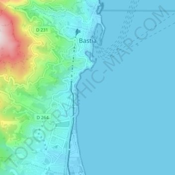
Name: Bastia topographic map, elevation, terrain.
Location: Bastia, Haute-Corse, Corsica, Metropolitan France, France (42.66121 9.39017 42.71089 9.45765)
Average elevation: 67 m
Minimum elevation: -3 m
Maximum elevation: 537 m
Other topographic maps
Click on a map to view its topography, its elevation and its terrain.
Monte Cinto
France > Corsica > Haute-Corse > Lozzi
The elevation of the mountain is 2,706 metres (8,878 ft) and so is its prominence, making it one of the most prominent peaks in Europe. It is the highest peak of the Monte Cinto massif, one of the four main massifs in Corsica.
Average elevation: 2,151 m
Faubourg Scarafaglie
France > Corsica > Haute-Corse > Corte > Faubourg Scarafaglie
Average elevation: 580 m