
Samford Creek topographic map
Interactive map
Click on the map to display elevation.
About this map
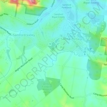
Name: Samford Creek topographic map, elevation, terrain.
Location: Samford Creek, Brisbane, Queensland, 452, Australia (-27.39643 152.85739 -27.36037 152.89325)
Average elevation: 73 m
Minimum elevation: 44 m
Maximum elevation: 173 m
Queensland trails, hiking, mountain biking, running and outdoor activities
Other topographic maps
Click on a map to view its topography, its elevation and its terrain.