
Upper Glastonbury topographic map
Interactive map
Click on the map to display elevation.
About this map
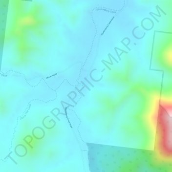
Name: Upper Glastonbury topographic map, elevation, terrain.
Location: Upper Glastonbury, Gympie, Queensland, Australia (-26.30583 152.47611 -26.28583 152.49611)
Average elevation: 176 m
Minimum elevation: 120 m
Maximum elevation: 441 m
Queensland trails, hiking, mountain biking, running and outdoor activities
Other topographic maps
Click on a map to view its topography, its elevation and its terrain.