
Borumba Creek topographic map
Interactive map
Click on the map to display elevation.
About this map
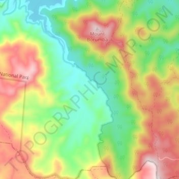
Name: Borumba Creek topographic map, elevation, terrain.
Location: Borumba Creek, Gympie, Queensland, Australia (-26.58376 152.56333 -26.52677 152.59488)
Average elevation: 336 m
Minimum elevation: 127 m
Maximum elevation: 612 m
Queensland trails, hiking, mountain biking, running and outdoor activities
Other topographic maps
Click on a map to view its topography, its elevation and its terrain.