Geolocate

Linz topographic map

Interactive map

Click on the map to display elevation.

About this map

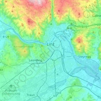
Name: Linz topographic map, elevation, terrain.

Location: Linz, Region Linz-Wels, Upper Austria, Austria (48.21137 14.24572 48.37869 14.40922)

Average elevation: 353 m

Minimum elevation: 240 m

Maximum elevation: 838 m

Other topographic maps

Click on a map to view its topography, its elevation and its terrain.

Thurnharting

Austria > Upper Austria > Bezirk Linz-Land

Average elevation: 324 m

Reiterndorf

Austria > Upper Austria > Bezirk Gmunden > Bad Ischl

Average elevation: 601 m

Loser

Austria > Upper Austria > Bezirk Gmunden > Ebensee

Average elevation: 709 m

Fucking

Austria > Upper Austria > Fucking

Average elevation: 470 m

Dietlgut

Austria > Upper Austria > Hinterstoder > Dietlgut

Average elevation: 931 m