
Leuchars topographic map
Interactive map
Click on the map to display elevation.
About this map
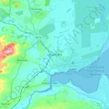
Name: Leuchars topographic map, elevation, terrain.
Location: Leuchars, Fife, Scotland, KY16 0HH, United Kingdom (56.34141 -2.92389 56.42141 -2.84389)
Average elevation: 22 m
Minimum elevation: -3 m
Maximum elevation: 187 m
Other topographic maps
Click on a map to view its topography, its elevation and its terrain.
Inverkeithing
United Kingdom > Scotland > Fife
Topographically, Inverkeithing is situated on a raised terrace sloping down towards Inverkeithing Bay, which cuts in to the south of the town, separating it from the North Queensferry peninsula. There are views from the town centre across the Firth of Forth to Edinburgh, Arthur's Seat, and the Pentland Hills.
Average elevation: 28 m