
Fitzroy Island topographic map
Interactive map
Click on the map to display elevation.
About this map
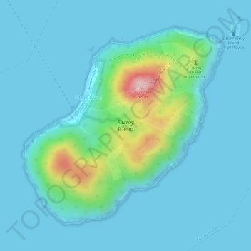
Name: Fitzroy Island topographic map, elevation, terrain.
Location: Fitzroy Island, Cairns, Queensland, Australia (-16.94347 145.98278 -16.92234 146.00511)
Average elevation: 35 m
Minimum elevation: -1 m
Maximum elevation: 235 m
Queensland trails, hiking, mountain biking, running and outdoor activities
Other topographic maps
Click on a map to view its topography, its elevation and its terrain.