
Wondecla topographic map
Interactive map
Click on the map to display elevation.
About this map
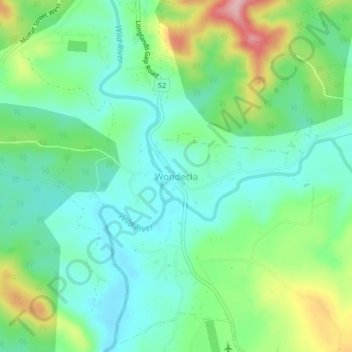
Name: Wondecla topographic map, elevation, terrain.
Location: Wondecla, Tablelands Regional, Queensland, 4887, Australia (-17.42961 145.37184 -17.38961 145.41184)
Average elevation: 899 m
Minimum elevation: 848 m
Maximum elevation: 1,016 m