
Cashmere topographic map
Interactive map
Click on the map to display elevation.
About this map
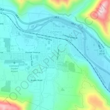
Name: Cashmere topographic map, elevation, terrain.
Location: Cashmere, Chelan County, Washington, 98815, United States (47.50746 -120.48868 47.52519 -120.44660)
Average elevation: 298 m
Minimum elevation: 222 m
Maximum elevation: 596 m
Other topographic maps
Click on a map to view its topography, its elevation and its terrain.
Mount David
United States > Washington > Chelan County
Mount David is a prominent 7,420-foot (2,260-metre) mountain summit located in Chelan County of Washington state. The mountain is situated in the Glacier Peak Wilderness, on land managed by the Okanogan-Wenatchee National Forest. Mount David is the highest point of Wenatchee Ridge, a subrange which also…
Average elevation: 1,736 m