Geolocate

Tugun Hill topographic map

Interactive map

Click on the map to display elevation.

About this map

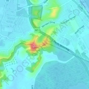
Name: Tugun Hill topographic map, elevation, terrain.

Location: Tugun Hill, Gold Coast, Queensland, 4224, Australia (-28.15754 153.48496 -28.15744 153.48506)

Average elevation: 13 m

Minimum elevation: -2 m

Maximum elevation: 90 m

Queensland trails, hiking, mountain biking, running and outdoor activities

Other topographic maps

Click on a map to view its topography, its elevation and its terrain.

Reedy Creek

Australia > Queensland > Gold Coast

Average elevation: 16 m

Reedy Creek

Australia > Queensland > Gold Coast

Average elevation: 40 m

Araucaria Forest

Australia > Queensland > Gold Coast

Average elevation: 6 m

Reedy Creek

Australia > Queensland > Gold Coast

Average elevation: 25 m

Coomera River

Australia > Queensland > Gold Coast

Average elevation: 563 m

Nerang River

Australia > Queensland > Gold Coast

Average elevation: 492 m

Kingsholme

Australia > Queensland > Gold Coast

Average elevation: 127 m