
Camp Mountain topographic map
Interactive map
Click on the map to display elevation.
About this map
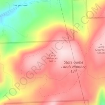
Name: Camp Mountain topographic map, elevation, terrain.
Average elevation: 483 m
Minimum elevation: 287 m
Maximum elevation: 597 m
Other topographic maps
Click on a map to view its topography, its elevation and its terrain.
Buckingham Township
United States of America > Pennsylvania > Buckingham Township
Average elevation: 90 m
Upper Southampton Township
United States of America > Pennsylvania > Upper Southampton Township
Average elevation: 74 m