
Darra topographic map
Interactive map
Click on the map to display elevation.
About this map
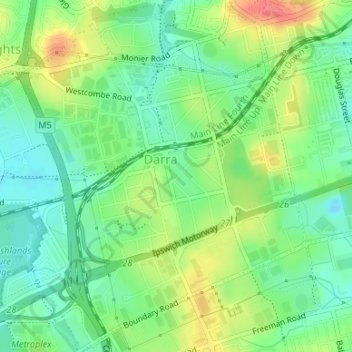
Name: Darra topographic map, elevation, terrain.
Location: Darra, Brisbane City, Queensland, 4076, Australia (-27.58292 152.93772 -27.55343 152.96655)
Average elevation: 33 m
Minimum elevation: 8 m
Maximum elevation: 71 m
Queensland trails, hiking, mountain biking, running and outdoor activities
Other topographic maps
Click on a map to view its topography, its elevation and its terrain.