
Emmen topographic map
Interactive map
Click on the map to display elevation.
About this map
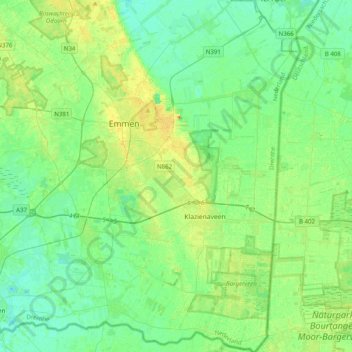
Name: Emmen topographic map, elevation, terrain.
Location: Emmen, Drenthe, Netherlands (52.63271 6.82636 52.87301 7.09274)
Average elevation: 16 m
Minimum elevation: 7 m
Maximum elevation: 36 m
Other topographic maps
Click on a map to view its topography, its elevation and its terrain.