
Mulgildie topographic map
Interactive map
Click on the map to display elevation.
About this map
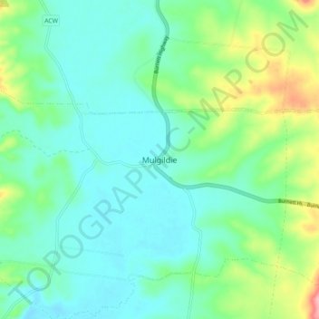
Name: Mulgildie topographic map, elevation, terrain.
Location: Mulgildie, Queensland, 4630, Australia (-25.00426 151.09231 -24.92426 151.17231)
Average elevation: 240 m
Minimum elevation: 207 m
Maximum elevation: 342 m
Queensland trails, hiking, mountain biking, running and outdoor activities