
Fishermans Pocket topographic map
Interactive map
Click on the map to display elevation.
About this map
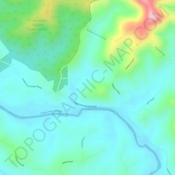
Name: Fishermans Pocket topographic map, elevation, terrain.
Location: Fishermans Pocket, Gympie, Queensland, Australia (-26.17667 152.59001 -26.15667 152.61001)
Average elevation: 87 m
Minimum elevation: 34 m
Maximum elevation: 248 m
Queensland trails, hiking, mountain biking, running and outdoor activities
Other topographic maps
Click on a map to view its topography, its elevation and its terrain.