
Rathdowney topographic map
Interactive map
Click on the map to display elevation.
About this map
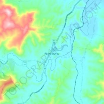
Name: Rathdowney topographic map, elevation, terrain.
Location: Rathdowney, Scenic Rim Regional, Queensland, Australia (-28.25006 152.82524 -28.17006 152.90524)
Average elevation: 160 m
Minimum elevation: 73 m
Maximum elevation: 462 m
Queensland trails, hiking, mountain biking, running and outdoor activities