
Sandakan Division topographic map
Interactive map
Click on the map to display elevation.
About this map
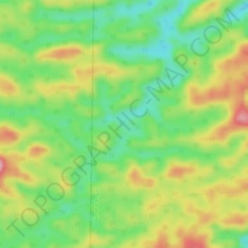
Name: Sandakan Division topographic map, elevation, terrain.
Location: Sandakan Division, Sabah, Malaysia (5.48001 117.47987 5.52001 117.51987)
Average elevation: 119 m
Minimum elevation: 49 m
Maximum elevation: 211 m
Other topographic maps
Click on a map to view its topography, its elevation and its terrain.
Gaya Island
Malaysia > Sabah > Kota Kinabalu
Gaya Island (Malay: Pulau Gaya) is a sizeable Malaysian island of 1,465 ha, just 10 minutes off Kota Kinabalu, Sabah and forms part of the Tunku Abdul Rahman National Park. Gaya Island derived its name from the Bajau word "Gayo" which means big and occupies an area of 15 km² (3,700 acres) with an elevation of…
Average elevation: 34 m