
Nerang River topographic map
Interactive map
Click on the map to display elevation.
About this map
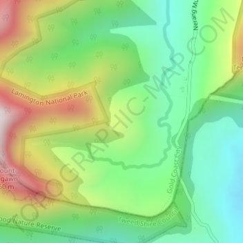
Name: Nerang River topographic map, elevation, terrain.
Location: Nerang River, Gold Coast, Queensland, Australia (-28.25967 153.21729 -28.24937 153.23462)
Average elevation: 492 m
Minimum elevation: 166 m
Maximum elevation: 1,034 m
Queensland trails, hiking, mountain biking, running and outdoor activities
Other topographic maps
Click on a map to view its topography, its elevation and its terrain.