
Devils Creek topographic map
Interactive map
Click on the map to display elevation.
About this map
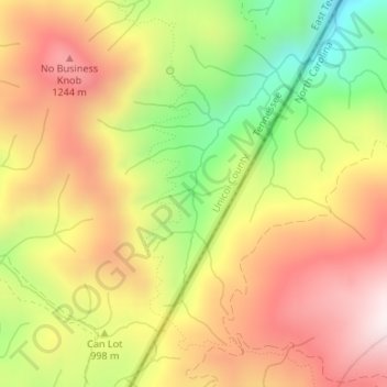
Name: Devils Creek topographic map, elevation, terrain.
Location: Devils Creek, Unicoi County, Tennessee, United States (36.05536 -82.43203 36.05589 -82.43188)
Average elevation: 1,029 m
Minimum elevation: 643 m
Maximum elevation: 1,353 m
Other topographic maps
Click on a map to view its topography, its elevation and its terrain.
Three Top Mountain;Threetop Mountain
United States > Tennessee > Cocke County
Average elevation: 766 m
Roan Mountain
United States > Tennessee > Carter County
Roan Mountain is located in northeast Tennessee at 36°11′39″N 82°4′6″W / 36.19417°N 82.06833°W / 36.19417; -82.06833 (36.194219, -82.068417). According to the United States Census Bureau, the CDP has a total area of 6.6 square miles (17.2 km2), all land. The elevation of Roan Mountain near…
Average elevation: 926 m
Tennessee River Pulp and Paper Company East Dam
United States > Tennessee > Hardin County
Average elevation: 129 m
Quail Run
United States > Tennessee > Rutherford County > Murfreesboro > Quail Run
Average elevation: 184 m
Clifton Hills
United States > Tennessee > Hamilton County > Chattanooga > Clifton Hills
Average elevation: 209 m
Townsend
United States > Tennessee > Blount County
Just to the north and west of Townsend, the Foothills Parkway is a national parkway that traverses Chilhowee Mountain and offers multiple scenic overlooks at high elevations, with views of the Smokies to the south and the Tennessee Valley and Cumberland Plateau to the north and west. As of 2016, road…
Average elevation: 376 m