Geolocate

DeSoto County topographic map

Interactive map

Click on the map to display elevation.

About this map

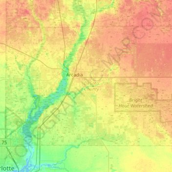
Name: DeSoto County topographic map, elevation, terrain.

Location: DeSoto County, Florida, USA (27.03170 -82.05758 27.34070 -81.56220)

Average elevation: 18 m

Minimum elevation: -1 m

Maximum elevation: 33 m

Other topographic maps

Click on a map to view its topography, its elevation and its terrain.

Spring Hill

USA > Florida > Spring Hill

Average elevation: 35 m

Gibsonton

USA > Florida > Gibsonton

Average elevation: 6 m

Gulf Harbor

USA > Florida > Gulf Harbor

Average elevation: 4 m

Yeet Pond

USA > Florida > Palm Coast

Average elevation: 7 m

The Slash

USA > Florida > Hollister

Average elevation: 7 m

Palm View

USA > Florida > Palm View

Average elevation: 5 m

Palm Island

USA > Florida > Miami Beach

Average elevation: 2 m