
Enoggera Creek topographic map
Interactive map
Click on the map to display elevation.
About this map
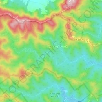
Name: Enoggera Creek topographic map, elevation, terrain.
Location: Enoggera Creek, Brisbane, Queensland, 4062, Australia (-27.44441 152.84089 -27.42671 152.89734)
Average elevation: 213 m
Minimum elevation: 90 m
Maximum elevation: 406 m
Queensland trails, hiking, mountain biking, running and outdoor activities
Other topographic maps
Click on a map to view its topography, its elevation and its terrain.