
Lamb Range topographic map
Interactive map
Click on the map to display elevation.
About this map
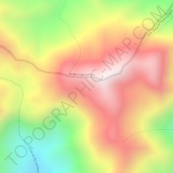
Name: Lamb Range topographic map, elevation, terrain.
Location: Lamb Range, Cairns, Queensland, Australia (-17.05778 145.67861 -17.03778 145.69861)
Average elevation: 749 m
Minimum elevation: 278 m
Maximum elevation: 1,091 m
Queensland trails, hiking, mountain biking, running and outdoor activities
Other topographic maps
Click on a map to view its topography, its elevation and its terrain.
Edmonton
Australia > Queensland > Cairns
The average elevation of Edmonton, Cairns is 16.8 metres (55.1 feet) above sea level.
Average elevation: 96 m