
Moogerah topographic map
Interactive map
Click on the map to display elevation.
About this map
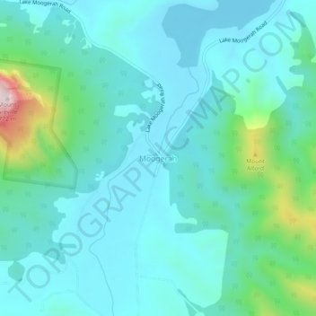
Name: Moogerah topographic map, elevation, terrain.
Location: Moogerah, Queensland, Australia (-28.10212 152.50434 -28.06212 152.54434)
Average elevation: 248 m
Minimum elevation: 148 m
Maximum elevation: 735 m
Queensland trails, hiking, mountain biking, running and outdoor activities
Other topographic maps
Click on a map to view its topography, its elevation and its terrain.