
Tin Can Bay topographic map
Interactive map
Click on the map to display elevation.
About this map
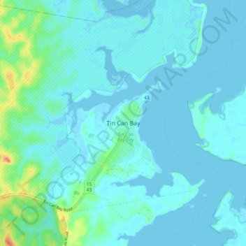
Name: Tin Can Bay topographic map, elevation, terrain.
Location: Tin Can Bay, Queensland, Australia (-25.95487 152.96144 -25.87487 153.04144)
Average elevation: 7 m
Minimum elevation: -2 m
Maximum elevation: 49 m
Queensland trails, hiking, mountain biking, running and outdoor activities
Other topographic maps
Click on a map to view its topography, its elevation and its terrain.