Geolocate

Pilton topographic map

Click on the map to display elevation.

About this map

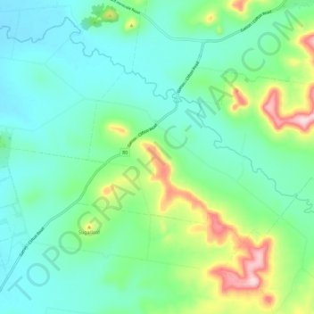
Name: Pilton topographic map, elevation, terrain.

Location: Pilton, Toowoomba Regional, Queensland, Australia (-27.90534 152.01860 -27.84947 152.13337)

Average elevation: 542 m

Minimum elevation: 463 m

Maximum elevation: 779 m

Queensland trails, hiking, mountain biking, running and outdoor activities

Gear up for your next adventure:

🎒40L Day Hiking Backpacks - Comfortable packs with hydration support for long days exploring topographic peaks
🧭Compass - Navigation compasses for outdoor exploration
🥾Hiking Boots - Durable hiking boots for trails and rough terrain
🧯Animal Deterrent Spray - Safety spray for wildlife
📡Portable Emergency Radios - Stay informed about weather warnings and bushfire alerts

As an Amazon Associate, this site earns from qualifying purchases at no extra cost to you.