
Lake Burley Griffin topographic map
Interactive map
Click on the map to display elevation.
Lake Burley Griffin
Charles Robert Scrivener (1855–1923) recommended the site for Canberra in 1909, which was to be a planned capital city for the country. One of the reasons for the location's selection was its ability to store water "for ornamental purposes at reasonable cost"; Scrivener's work had demonstrated that the topography could be used to create a lake through flooding.
About this map
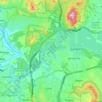
Name: Lake Burley Griffin topographic map, elevation, terrain.
Average elevation: 589 m
Minimum elevation: 508 m
Maximum elevation: 811 m
Australia trails, hiking, mountain biking, running and outdoor activities
Other topographic maps
Click on a map to view its topography, its elevation and its terrain.