
Lake Moogerah topographic map
Interactive map
Click on the map to display elevation.
About this map
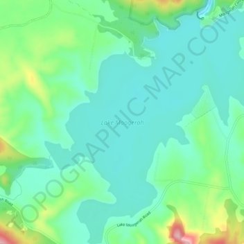
Name: Lake Moogerah topographic map, elevation, terrain.
Average elevation: 174 m
Minimum elevation: 128 m
Maximum elevation: 311 m
Other topographic maps
Click on a map to view its topography, its elevation and its terrain.
Mount Alford
Australia > Queensland > Moogerah
Mount Alford, Moogerah, Scenic Rim Regional, Queensland, Australia
Average elevation: 290 m