
Bexhill-on-Sea topographic map
Interactive map
Click on the map to display elevation.
About this map
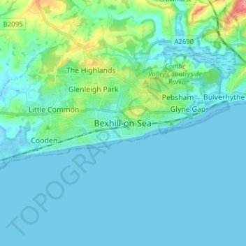
Name: Bexhill-on-Sea topographic map, elevation, terrain.
Average elevation: 13 m
Minimum elevation: -2 m
Maximum elevation: 84 m
Other topographic maps
Click on a map to view its topography, its elevation and its terrain.
Camber
United Kingdom > England > East Sussex > Rother
Camber, Rother, East Sussex, England, United Kingdom
Average elevation: 1 m
Winchelsea
United Kingdom > England > East Sussex > Rother
Winchelsea, Rother District, East Sussex, England, TN36 4EN, United Kingdom
Average elevation: 12 m