
Waitākere Ranges topographic map
Interactive map
Click on the map to display elevation.
About this map
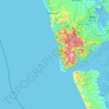
Name: Waitākere Ranges topographic map, elevation, terrain.
Location: Waitākere Ranges, Auckland, New Zealand (-37.13179 174.17292 -36.83290 174.69356)
Average elevation: 33 m
Minimum elevation: -1 m
Maximum elevation: 453 m
Other topographic maps
Click on a map to view its topography, its elevation and its terrain.