
Bohle River topographic map
Interactive map
Click on the map to display elevation.
About this map
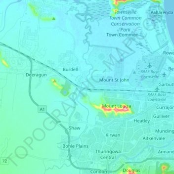
Name: Bohle River topographic map, elevation, terrain.
Location: Bohle River, Townsville, Queensland, 4814, Australia (-19.32982 146.70090 -19.19360 146.71525)
Average elevation: 14 m
Minimum elevation: -3 m
Maximum elevation: 191 m
Queensland trails, hiking, mountain biking, running and outdoor activities
Other topographic maps
Click on a map to view its topography, its elevation and its terrain.