Geolocate

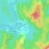
Rosebery topographic maps

Click on a map to view its topography, its elevation and its terrain.

Rosebery

Australia > Tasmania > Rosebery

Average elevation: 359 m

Gear up for your next adventure:

🧳Outdoor Travel Organizers - Gear organization accessories
📡Portable Emergency Radios - Stay informed about weather warnings and bushfire alerts
🚁Camera Drones with GPS - Capture aerial views of the landscape to compare with topo maps
🎒Dry Bags - Waterproof bags for outdoor gear
🩹Wilderness First Aid Kits - Comprehensive medical kits tailored for hiking and remote exploration

As an Amazon Associate, this site earns from qualifying purchases at no extra cost to you.