Geolocate

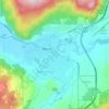
Merritt topographic maps

Click on a map to view its topography, its elevation and its terrain.

Merritt

Canada > British Columbia > Merritt

Average elevation: 701 m

Gear up for your next adventure:

🌿Flora and Fauna Field Guides - Identify the plants and animals you encounter on your route
🎒3L Hydration Reservoirs - Hands-free drinking to stay hydrated on steep contour climbs
📖Australian Bush Survival Books - Local knowledge on finding water and surviving the outback
📱Shockproof Phone Cases - Extra protection for your smartphone against drops on rocky terrain
📡Portable Emergency Radios - Stay informed about weather warnings and bushfire alerts

As an Amazon Associate, this site earns from qualifying purchases at no extra cost to you.