Geolocate

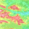
Roth topographic maps

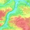
Click on a map to view its topography, its elevation and its terrain.

Großhöbing

Germany > Bavaria > Roth > Greding > Untermässing

Average elevation: 469 m

Fünfbronn

Germany > Bavaria > Roth > Spalt

Average elevation: 456 m

Spalt

Germany > Bavaria > Roth

Average elevation: 421 m

Büchenbach

Germany > Bavaria > Roth

Average elevation: 363 m

Hilpoltstein

Germany > Bavaria > Roth

Average elevation: 418 m

Georgensgmünd

Germany > Bavaria > Roth

Average elevation: 387 m

91161

Germany > Bavaria > Roth > Hilpoltstein > Grauwinkl

Average elevation: 438 m

Kiliansdorf

Germany > Bavaria > Roth > Roth

Average elevation: 362 m

Greding

Germany > Bavaria > Roth

Average elevation: 488 m

About this place

 •  •  •

Gear up for your next adventure:

🧼Biodegradable Soap - Eco-friendly outdoor soap
🏕️Camping Gear - Essential camping equipment
🧴SPF 50+ Bulk Sunscreen - Maximum protection for long-term outdoor exposure
🧤Thermal Hiking Gloves - Keep your hands warm and functional during high-altitude winter treks
📍Handheld GPS - GPS devices for hiking and navigation

As an Amazon Associate, this site earns from qualifying purchases at no extra cost to you.