Geolocate

Isumi topographic maps

Click on a map to view its topography, its elevation and its terrain.
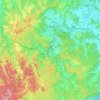
Otaki

Japan > Isumi

Ōtaki is a landlocked town in the center of the Bōsō Peninsula, about 35 kilometers from the prefectural capital at Chiba and 60 to 70 kilometers from central Tokyo. The southwest area of Ōtaki is mountainous, with elevations gradually lowering towards the northeast of the town. Approximately 70% of Ōtaki…

Average elevation: 114 m

Gear up for your next adventure:

🧦Merino Wool Hiking Socks - Moisture-wicking socks to prevent blisters during long topographic surveys
👟Lightweight Trail Runners - Agile footwear for fast movement over rugged Australian terrain
🎨Portable Watercolor Kits - Paint the landscapes and topographic views you discover
🔌Fast Charging Adapters - Quickly top up all your gear before heading back into the field
📡Portable Emergency Radios - Stay informed about weather warnings and bushfire alerts

As an Amazon Associate, this site earns from qualifying purchases at no extra cost to you.