
Khuvsgul-See topographic map
Interactive map
Click on the map to display elevation.
About this map
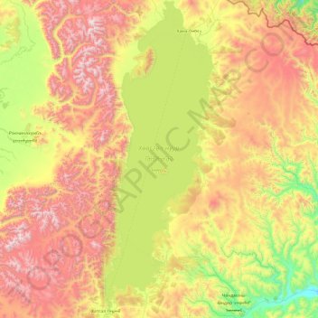
Name: Khuvsgul-See topographic map, elevation, terrain.
Location: Khuvsgul-See, Khankh, Chöwsgöl, Mongolei (50.41877 100.14985 51.62125 100.80543)
Average elevation: 1,897 m
Minimum elevation: 1,138 m
Maximum elevation: 3,150 m
Other topographic maps
Click on a map to view its topography, its elevation and its terrain.
Мунку-Сардык
Mongolei > Chöwsgöl > Renchinlkhümbe
Мунку-Сардык, Renchinlkhümbe, Chöwsgöl, Mongolei
Average elevation: 2,712 m