Geolocate

Gratz topographic map

Click on the map to display elevation.

About this map
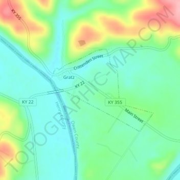
Name: Gratz topographic map, elevation, terrain.

Location: Gratz, Owen County, Kentucky, United States (38.46549 -84.95638 38.47790 -84.93656)

Average elevation: 173 m

Minimum elevation: 132 m

Maximum elevation: 255 m

Other topographic maps

Click on a map to view its topography, its elevation and its terrain.
Perry Park

United States > Kentucky > Owen County

Average elevation: 173 m

New Liberty

United States > Kentucky > Owen County

Average elevation: 253 m

Breck

United States > Kentucky > Owen County

Average elevation: 247 m

New Liberty

United States > Kentucky > Owen County

Average elevation: 253 m

Gear up for your next adventure:

🪢Paracord - Multi-purpose survival cord
🔥Camping Stoves - Portable stoves for outdoor cooking
🩹First Aid Kits - Emergency kits for hiking
🔭Compact Hiking Binoculars - Lightweight optics for scouting routes or birdwatching
🍴Titanium Spork & Cutlery - Indestructible and feather-light eating utensils

As an Amazon Associate, this site earns from qualifying purchases at no extra cost to you.