Geolocate

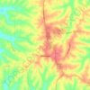
Breck topographic map

Click on the map to display elevation.

About this map

Name: Breck topographic map, elevation, terrain.

Location: Breck, Owen County, Kentucky, United States (38.47590 -84.75550 38.51590 -84.71550)

Average elevation: 247 m

Minimum elevation: 212 m

Maximum elevation: 280 m

Other topographic maps

Click on a map to view its topography, its elevation and its terrain.

Monterey

United States > Kentucky > Owen County

Average elevation: 185 m

Owenton

United States > Kentucky > Owen County

Average elevation: 274 m

Gratz

United States > Kentucky > Owen County

Average elevation: 173 m

Owenton

United States > Kentucky > Owen County

Average elevation: 274 m

Gear up for your next adventure:

📱Shockproof Phone Cases - Extra protection for your smartphone against drops on rocky terrain
🧤Hiking Gloves - Protective gloves for outdoor use
🔥Ferrocerium Rod Fire Starters - Reliable fire lighting in wet or windy conditions without matches
🧺Waterproof Dry Sacks - Organize your pack and keep electronics safe from rain and river crossings
🔭Compact Hiking Binoculars - Lightweight optics for scouting routes or birdwatching

As an Amazon Associate, this site earns from qualifying purchases at no extra cost to you.