Geolocate

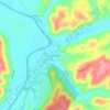
Monterey topographic map

Click on the map to display elevation.

About this map

Name: Monterey topographic map, elevation, terrain.

Location: Monterey, Owen County, Kentucky, United States (38.41865 -84.87955 38.42839 -84.86639)

Average elevation: 185 m

Minimum elevation: 132 m

Maximum elevation: 270 m

Other topographic maps

Click on a map to view its topography, its elevation and its terrain.

Breck

United States > Kentucky > Owen County

Average elevation: 247 m

Perry Park

United States > Kentucky > Owen County

Average elevation: 173 m

New Liberty

United States > Kentucky > Owen County

Average elevation: 253 m

New Liberty

United States > Kentucky > Owen County

Average elevation: 253 m

Gear up for your next adventure:

🍳Ultralight Camping Stoves - Boil water quickly for meals using minimal fuel
⌚Altimeter Barometer Watches - Outdoor watches with built-in sensors to track altitude changes and weather shifts
🔋Rechargeable Batteries - Eco-friendly power for high-drain GPS units and flashlights
👣Snake & Scrub Gaiters - Protection against spinifex, mud, and snakes while walking off-track
🩹Blister Prevention Tape - Apply to friction points before they become painful sores

As an Amazon Associate, this site earns from qualifying purchases at no extra cost to you.