
Make a donation
Gear up for your next adventure:
As an Amazon Associate, this site earns from qualifying purchases at no extra cost to you.
Wislow Island topographic map
Click on the map to display elevation.
Make a donation
Gear up for your next adventure:
As an Amazon Associate, this site earns from qualifying purchases at no extra cost to you.
About this map
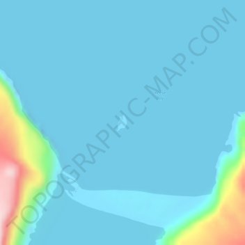
Name: Wislow Island topographic map, elevation, terrain.
Average elevation: 28 m
Minimum elevation: -13 m
Maximum elevation: 279 m
Make a donation
Gear up for your next adventure:
As an Amazon Associate, this site earns from qualifying purchases at no extra cost to you.
Other topographic maps
Click on a map to view its topography, its elevation and its terrain.
Chagulak Island
United States > Alaska > Aleutians West Census Area
Chagulak Island (also spelled Chugul, Chugula, Chegoula, or Tchougoulok; Russian: Чагулак) is a small, uninhabited volcanic island in the Islands of Four Mountains group in the Aleutian Islands of southwestern Alaska, United States. The 1.9 mi (3.1 km)-wide island consists of a single cone that reaches…
Average elevation: 160 m
Make a donation
Gear up for your next adventure:
As an Amazon Associate, this site earns from qualifying purchases at no extra cost to you.