
Province of Canchis topographic map
Interactive map
Click on the map to display elevation.
About this map
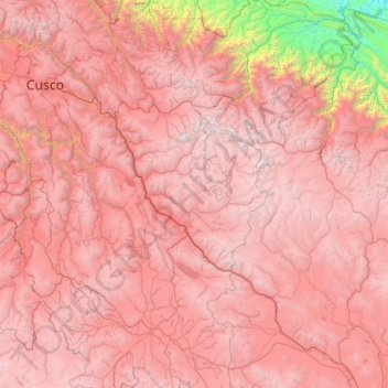
Name: Province of Canchis topographic map, elevation, terrain.
Location: Province of Canchis, Cusco, Peru (-15.08194 -72.18556 -13.08194 -70.18556)
Average elevation: 3,832 m
Minimum elevation: 300 m
Maximum elevation: 6,142 m
Other topographic maps
Click on a map to view its topography, its elevation and its terrain.
Otishi National Park
Otishi National Park, Echarate, Province of La Convención, Cusco, Peru
Average elevation: 1,276 m
San Miguel
Peru > Cusco > Machupicchu > Intihuatana
San Miguel, Intihuatana, Machupicchu, Province of Urubamba, Cusco, 08680, Peru
Average elevation: 2,262 m
Machupicchu
Peru > Cusco > Machupicchu
Machupicchu, Province of Urubamba, Cusco, Peru
Average elevation: 3,640 m